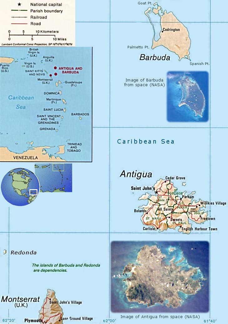
Antigua and Barbuda flagAntigua and Barbuda is an independent state since 1981. The island of Antigua is a low-lying, semiarid, limestone island of the Lesser Antilles. Antigua has severely eroded volcanic remnants along its forested southwestern quadrant, which has a maximum elevation of only 402 meters above sea level. Although Antigua receives approximately 40 inches (100 centimeters) of precipitation annually, wide fluctuations in rainfall amounts occasionally create serious water shortages, especially for the agricultural industry. Some of the larger hotels transport water by barge from nearby islands when water supplies become critically low. At one time Antigua’s economy was based largely on the sugarcane industry, but light manufacturing and tourism are now the leading contributors to the island’s economy. St. John’s, the country’s capital, is located along the northwest coast, adjacent to one of the Antigua’s many natural harbors. More than half of the country’s population of almost 70.000 live in the St. John’s area. The island of Antigua is approximately 25 km east-west and 19 km north-south (NASA).


america maps


Central America map


Antigua and Barbuda Map

America maps


English Harbour, Antigua.


Source: U.S. Central Intelligence Agency.


Antigua


Country Maps - Americas

Argentina

Bahamas

Barbados

Belize

Bolivia

Brazil

Canada

Chile

Colombia

Costa Rica

Cuba

Dominica

Dominican Republic

El Salvador

Ecuador

Grenada

Guatemala

Guyana

Haiti

Honduras

Jamaica

Mexico

Nicaragua

Panama

Paraguay

Peru

Saint Lucia

St Kitts & Nevis

St Vincent & the Grenadines

Suriname

Trinidad & Tobago

Uruguay

USA

Venezuela


Caribbean


Central America Map


North America


◄America maps

◄World maps


Antigua and Barbuda map


Google


All rights reserved