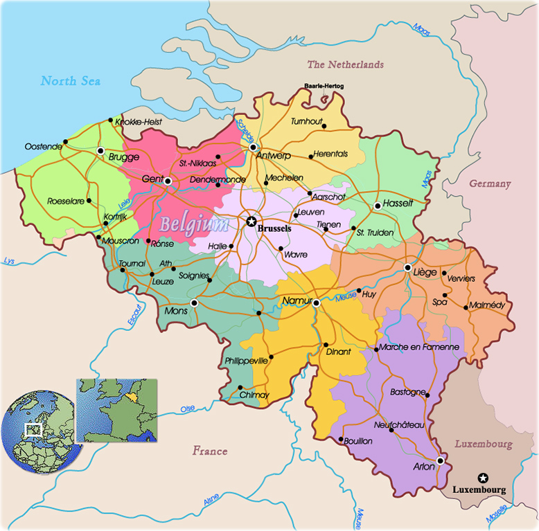
Political Map of Belgium
Belgium is an independent country situated in the west of Europe, bordered to the north by the Netherlands, to the east by Germany and the Grand Duchy of Luxembourg and to the south and the west by France.
Belgium has three major areas: lower Belgium (up to 100m above sea level), central Belgium (between 100 and 200m above sea level) and upper Belgium (from 200 to over 500m above sea level).
The capital is Brussels.
|
Copyright © Geographic Guide - World in Pictures, European Continent. |