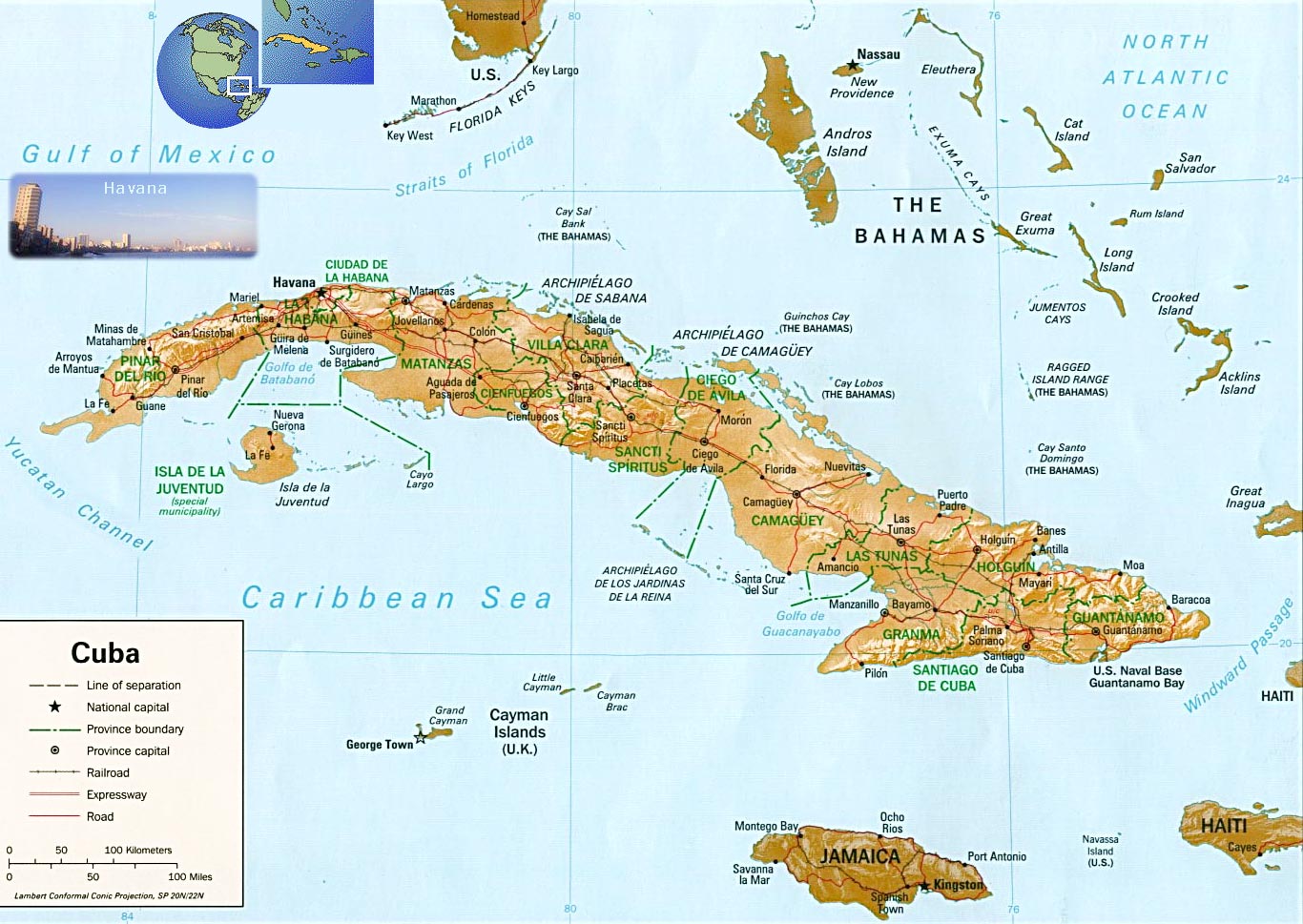
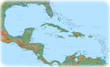
Map of Cuba
The largest island in the Caribbean.
The Republic of Cuba has 15 provinces: Artemisa, Camaguey, Ciego de Avila, Cienfuegos, Granma, Guantanamo, Holguin, La Habana, Las Tunas, Matanzas, Mayabeque, Pinar del Rio, Sancti Spiritus, Santiago de Cuba and Villa Clara. Isla de la Juventud is a special municipality. The major seaports are Antilla, Cienfuegos, Havana, Matanzas, Mariel, Nuevitas Bay and Santiago de Cuba.
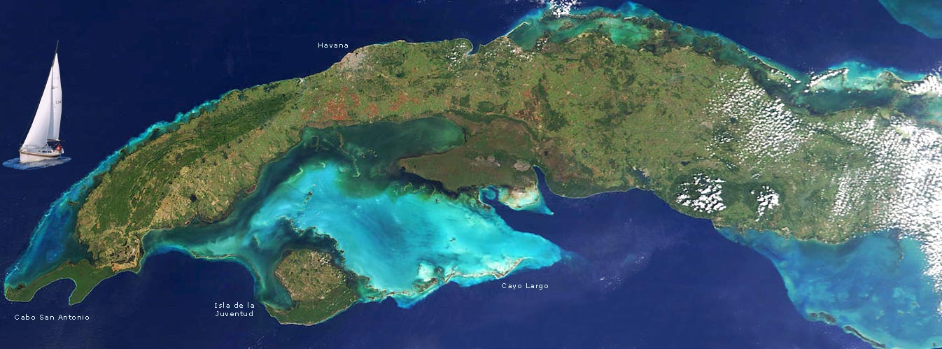
Image of the western part of Cuba. The capital, Havana, makes a grayish patch along the green, northern coastline. The Gauniguanico Mountains dominate the western tip of the island, and appear darker green than the coastal terrain. Across the Batabano Bay, the dark green color of the peninsula is due to lush wetlands (NASA - 2002).
|
Copyright © Geographic Guide - World in Pictures, American Continent. |
All rights reserved |