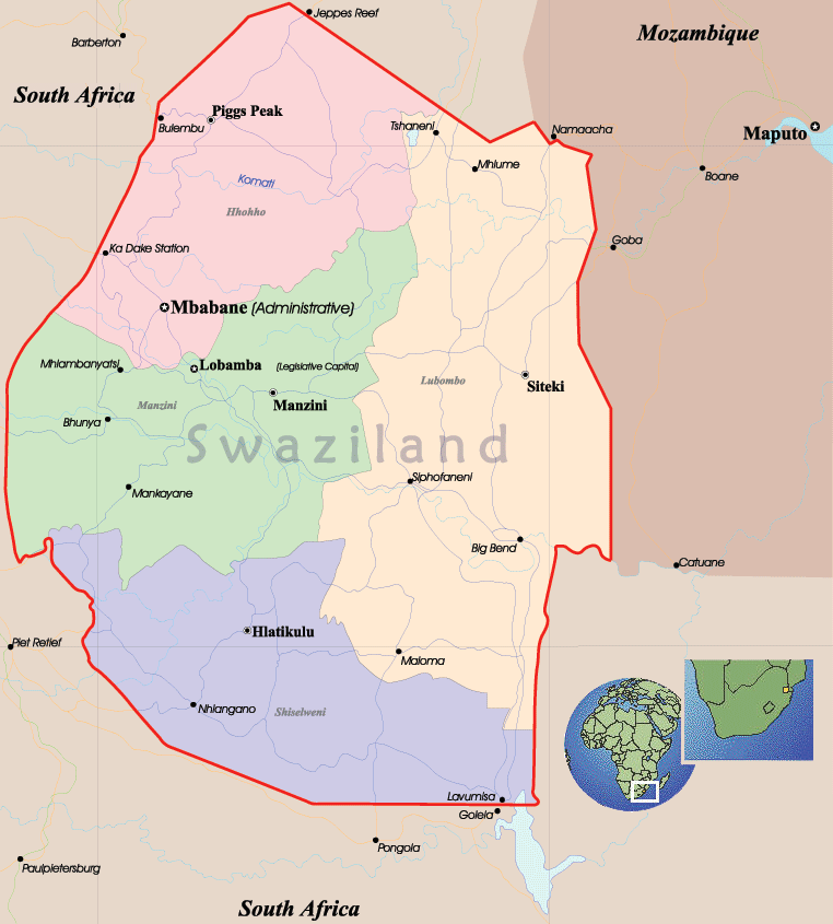
Eswatini / Swaziland Map
Swaziland is an independent monarchy in southeastern Africa, bordered, on the east, by Mozambique and on the southeast, south, west, and north by South Africa. Its total area is 17,363 km².
On 19 April 2018, Mswati III announced that the Kingdom of Swaziland had been renamed as the Kingdom of Eswatini, reflecting the extant Swazi name for the state eSwatini, to mark the 50th anniversary of Swazi independence. The name Eswatini means "land of the Swazis" in the Swazi language.
|
Copyright © Geographic Guide - World in Pictures. African Continent. |